The Smart Cities Award attracted the most competition of all the categories in the 2020 IoT Awards – the official awards program of IoT Alliance Australia (IoTAA), the peak Australian Internet of Things (IoT) industry body, and IoT Hub.
One of the standout stories in this category was the use of sensors to monitor pedestrian numbers during the pandemic. We received a number of nominations for such projects, and they show that some councils see a use for sensor data during crises.
Several data sharing projects also stood out. Read below about how finalists in Western Australia and Victoria are taking steps to bring IoT data together – and not just for their own use.
The 2020 IoT Awards - Smart Cities finalists
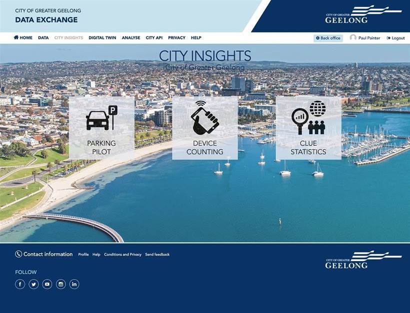
Geelong Data Exchange
The Geelong Data Exchange is a public data sharing portal designed to enable data collaboration between councils, via an open API and the provision of easy-to-use visualisation tools.
The portal combines more than 130 data sets, including real-time IoT data and geospatial, static and business system data. Dashboards display real-time people-counts and data about parking and land space usage.
Neighbouring Ballarat has also used the platform, to establish the Ballarat Data Exchange. It uses more than 50 datasets, with dashboards displaying information about parking, and weather at Lake Wendouree.
Southern Grampians Shire Council is also using the platform, in particular to make real-time, highly localised weather data available to local farmers.
Other Victorian councils can also sign up to use the platform, says Paul Painter, Director and Co-Owner of Peclet Technology. "The platform has been designed from the outset to on-board any other Victorian councils,” Painter explains.
The Geelong Data Exchange uses the Opendatasoft platform. It was configured by Peclet Technology, which also provided services to ingest data from different sources, transform the data and visualise it using an Opendatasoft dashboard.
The project also encourages community involvement by providing data visualisation tools the public can use to build and share data visualisations.
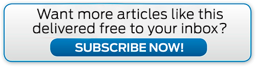
Real-time sensing to support community COVID-19 response in Perth
This City of Perth project used low cost Wi-Fi sensors, the city's LoRa network and data dashboards to inform COVID-19 response at a state and local level.
By the time the pandemic occurred, sensors connected via LoRA had been deployed in various Perth businesses, which were given access to data dashboards showing real-time data. Sensors had also been deployed in shopping centres, tourist destinations, museums, concert halls and parks.
During the pandemic, dashboards displaying IoT data were created for the Western Australia Department of Treasury, Tourism WA, Western Australia Police Force, DevelopmentWA, Western Australia Department of Premier and Cabinet, the state government incident management team and commercial property stakeholders.
Those dashboards combined the Wi-Fi activity data with data about weather, vehicle movement, airport activity and other factors. Weekly reports incorporated sensor data to provide insights about economic activity.
Sensors were also lent to neighbouring councils for use in their COVID-19 response – the City of Fremantle and City of Rockingham shared sensors and received data dashboards.
The public LoRa network and the low price of sensors made it possible to install devices where decision makers needed insight.
The city has also explained the solution to other capital cities, small regional towns and industry groups, through conference calls and technology demonstrations
The project also involved SimplyCity, Divergent and Meshed.
Northern Melbourne Smart Cities Network, enabling data to drive change
This is another data sharing project that involves multiple councils and has the potential to involve more.
The network is enabling five councils – City of Whittlesea, Banyule City Council, Moreland City Council, Nillumbik Shire Council and Mitchell Shire Council – to explore different sensors inexpensively and work out how data access could inform council process and improve services.
Collaboration and sharing of resources, risks and opportunities is also on the participants’ agenda.
The network connects gateways and sensors for people counting, asset tracking, managing waste, and monitoring air quality, other environmental factors and water levels.
Visualisation dashboards have been developed for the public, displaying data about air quality at parks and water levels in lakes, for example.
Integration with The Things Network makes it possible for residents and businesses to integrate their own sensors with the network. The aim is to enable the community to “drive their own data-based solutions to everyday problems”.
The level of sensor traffic on the network indicates community interest in such networks and data, according to those behind the project.
Councils also have access to dashboards showing how full rubbish bins are and how many people have visited a public space.
The project has also involved RMIT, La Trobe University and Minnovation Australia.
Understanding pedestrian activity to support COVID-19 response in Melbourne
This City of Melbourne project also used a pedestrian sensor network to determine the effect of COVID-19 restrictions.
When the pandemic occurred, the city already had pedestrian sensors in place, having begun its pedestrian sensor network project way back in 2008.
The sensors can now be found in such locations as main transport hubs and areas of the city used by shoppers, visitors and students.
The project has provided a “daily understanding of the pulse of the city”. The City of Melbourne sees the data as a proxy for changes in the type of activity within the city. For example, it uses data from a Bourke Street Mall sensor as an indication of retail activity.
This enables the Council to quantify changes in foot traffic in and around construction sites, for example, which affects businesses.
And during the pandemic, the data has also been used to determine the effect of COVID-19 restrictions on pedestrian numbers. The sensors fed multiple insight assessments, dashboards and models to determine the change in foot traffic in the city.
Pedestrian activity data is published on City of Melbourne’s Open Data Platform and pedestrian visualisation web site.
Register here to watch the 2020 IoT Awards presentation.